Key to Chayanda’s treasures
Gazprom Geologorazvedka completed large-scale seismic survey operations at the Chayandinskoye oil, gas & condensate field in the Republic of Sakha (Yakutia).
Here the company applied the high-density wide azimuth (WAZ) 3D survey method for the first time ever. Not too long before the end of the investigations the field was visited by Far Eastern media representatives to get acquainted with the modern prospecting technologies. This photo essay is based on the pictures made by the press tour participants.
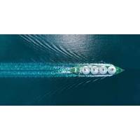
The scope of geophysical exploration in the Chayanda licensed block covered 6.300 square meters. Gazprom Geologorazvedka conducted seismic surveys across the area of 5.800 square meters. Even the pictures taken from a helicopter can’t convey the tremendous scale of this project.
In order to make the seismic survey efficient, the field is divided into eight subsections with the areas from 600 to 800 square meters in size. The research was conducted by three seismic crews totaling about one thousand people.
Once the seismic receivers and transmission modules are installed and their operability is tested by the seismic station, huge machines – NOMAD-65 seismic vibrators (from French ‘nomad’ – ‘wanderer’) come into action.
These ‘wanderers’ stop only to make a small artificial earthquake. The cameraman of the Amur State TV and Radio Broadcasting Company films the process: a massive plate comes out from under the vehicle bottom and excites a seismic wave. A blast – and energy penetrates the subsurface, ricochets from dense formations and goes back, while the vibrations are recorded by the seismic receivers installed in advance.
The collected data is delivered through the transmission modules to the seismic station which is also located here at the section. It is called the backbone of the seismic survey procedure. Instructions for vibrator operators are given from here and it also monitors the integrity of seismic recording equipment.
Alexander Pogretsky, Head of the Geophysical Operations and Surveys Division of Gazprom Geologorazvedka explains the advantages of the high-density wide azimuth technique to the journalists: “2D seismic makes it possible to get only a vertical cross section of the earth’s crust, while the 3D survey results in a three-dimensional image of the field’s subsurface. It was for the first time ever in Russia that this method was applied on such a vast area.”
Further processing and interpretation of the data obtained during the surveys will allow Gazprom Geologorazvedka to develop a 3D model of the Chayandinskoye oil, gas & condensate field, which will help to detect the most prospective areas for drilling. First gas is to be produced at the field in late 2018.