Barents Sea Metocean and Ice Networks Project Underway

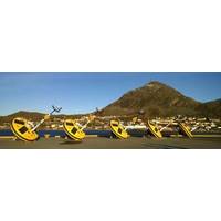
Fugro informs it has begun a three-year metocean and ice data acquisition as part of the Barents Sea Metocean and Ice Network Project. The Norwegian Petroleum Safety Authority, recognizing the Barents Sea represents a frontier region for oil and gas exploration, in its guidance states that appropriate measures to mitigate risk should be undertaken. Statoil is leading a Joint Industry Project (JIP) to gather additional and necessary metocean and ice data in the region. Early acquisition of data in frontier regions is key to reducing risk for operators which…
Harris CapRock Connectivity Assists Oceaneering ROV Ops

Technology from Harris CapRock Communications is enabling Oceaneering International, Inc. to remotely pilot and automatically control its NEXXUS remotely operated vehicle ROV. Harris CapRock is providing satellite bandwidth and service to operate the ROV, which enables the pilot to execute assignments ranging from simple video monitoring to highly complex vessel inspection tasks. The satellite link enables Oceaneering to pilot the ROV from offshore, from another vessel, or from an onshore command center.
FUGRO Supports AlVheim Improved Oil Recovery Project

Fugro is providing wave measurements to support construction operations at an improved oil recovery (IOR) project on the Norwegian continental shelf, around 225 kilometres west of Stavanger. The subsea infrastructure on the Alvheim field (operated by Det norske oljeselskap ASA) is being extended by offshore construction expert Technip and involves four areas that are being tied-in via subsea wells to improve oil production rates. Technip’s subsea operations – the installation and tie-in of spools and protection covers, along with a manifold – are being performed at depths of around 120 to 130 metres.
